Durrës (Bashkia Durrës)
Durrës (, ; Durrësi) is the second most populous city of the Republic of Albania and seat of Durrës County and Durrës Municipality. It is located on a flat plain along the Albanian Adriatic Sea Coast between the mouths of the Erzen and Ishëm at the southeastern corner of the Adriatic Sea. Durrës' climate is profoundly influenced by a seasonal Mediterranean climate.
Durrës was founded by Ancient Greek colonists from Corinth and Corcyra under the name of Epidamnos around the 7th century BC in cooperation with the local Illyrian Taulantii. Also known as Dyrrachium, Durrës essentially developed as it became an integral part of the Roman Empire and its successor the Byzantine Empire. The Via Egnatia, the continuation of the Via Appia, started in the city and led across the interior of the Balkan Peninsula to Constantinople in the east.
In the Middle Ages, Durrës was contested between Bulgarian, Venetian and Ottoman dominions. The Ottomans ultimately prevailed, ruling the city for more than 400 years from 1501 until 1912. Following the Albanian Declaration of Independence, the city served as the capital of the Principality of Albania for a short period of time. Subsequently, it was annexed by the Kingdom of Italy in the interwar period and was occupied by Nazi Germany during World War II. Durrës experienced a strong expansion in its demography and economic activity during the Communism in Albania.
The transport connections, concentration of economic institutions and industrial tradition underlie Durrës' leading economic position in Albania. It is served by the Port of Durrës, one of the largest on the Adriatic Sea, which connects the city to other neighbouring countries. Its most considerable attraction is the Amphitheatre of Durrës that is included on the Albanian tentative list for designation as a UNESCO World Heritage Site. Once having a capacity for 20,000 people, it is the largest amphitheatre in the Balkan Peninsula.
In antiquity, the city was known as Epidamnos (Ἐπίδαμνος) and Dyrrhachion (Δυρράχιον) in classical Greek and then Epidamnus and Dyrrachium in classical Latin. Epidamnos is the older known of the two Greek toponyms; it is widely considered to be of Illyrian origin, as first proposed by linguist Hans Krahe, and is attested in Thucydides (5th century BC), Aristotle (4th century BC), and Polybius (2nd century BC). Etymologically, Epidamnos may be related to Proto-Albanian *dami (cub, young animal, young bull) > dem (modern Albanian) as proposed by linguist Eqrem Çabej. Although the name Epidamnos/Epidamnus was more commonly used among Ancient Greek authors, the coinage of the city only used the abbreviations for the name Dyrrhachion/Dyrrhachium. Dyrrachium was chosen as the sole name of the city after the Roman Republic got control of the region after the Illyrian Wars in 229 BC. The Latin spelling of /y/ retained the form of Doric Greek Dyrrhachion, which was pronounced as /Durrakhion/. This change of the name is already attested in classical literature. Titus Livius, at the end of the first century BC, writes in Ab Urbe Condita Libri that at the time of the Illyrian Wars (roughly 200 years earlier) the city was not known as Dyrrachium, but as Epidamnus. Pomponius Mela, about 70 years later than Titus Livius, attributed the change of the name to the fact that the name Epidamnos reminded the Romans of the Latin word damnum, which signified evil and bad luck; Pliny the Elder, who lived in the same period, repeated this explanation in his own works. However, the Romans may have adopted the new name because it was already in more frequent use by citizens of the city.
The name Dyrrhachion is usually explained as a Greek compound from δυσ- 'bad' and ῥαχία 'rocky shore, flood, roaring waves', an explanation already hinted at in antiquity by Cassius Dio, who writes it referred to the difficulties of the rocky coastline, while also reporting that other Roman authors linked it to the name of an eponymous hero Dyrrachius. The mythological construction of the city's name was recorded by Appian (2nd century AD) who wrote that "the king of the barbarians of this country, Epidamnus gave the name to the city. His daughter's son Dyrrachius, built a port near the town that he called Dyrrachium". Stephanus of Byzantium repeated this mythological construction in his work. It is unclear whether the two toponyms referred originally to different areas of the territory of the city or whether they referred to the same territory. Classical literature indicates that they more probably referred to different neighbouring areas originally. Gradually, the name Epidamnus fell out of use and Dyrrachium became the sole name for the city. Archaeological research has shown that at the time of the foundation of Durrës, two distinct settlements existed on its territory. The first one is a hill site with no direct contact with the sea. It predates the colony and might represent the settlement which held the toponym known as Epidamnos in ancient literature. The hill site overlooks to its south the second site which is the territory of the port of Durrës, where the colony was founded. Its location on a rocky shore struck by waves on all sides reflects the description of the toponym Dyrrhachion. The distinction between these two districts of the city remained in place even much later. In the 19th century, Durrës proper was the district of the port, while the hill north of it was a separate settlement, Stani (Kodra e Stanit).
The modern names of the city in Albanian (Durrës) and Italian (Durazzo, ) are derived from Dyrrachium/Dyrrachion. An intermediate, palatalized antecedent is found in the form Dyrratio, attested in the early centuries AD. The palatalized /-tio/ ending probably represents a phonetic change in the way the inhabitants of the city pronounced its name. The preservation of old Doric /u/ indicates that the modern name derives from populations to whom the toponym was known in its original Doric pronunciation. By contrast, in Byzantine Greek, the name of the city is pronounced with the much later evolution of /u/ as /i/. The modern Italian name evolved in the sub-dialects that emerged from Colloquial Latin in northern Italy. The modern Albanian name evolved independently from the parent language of Albanian around the same period of the post-Roman era in the first centuries AD as the difference in stress in the two toponyms (first syllable in Albanian, second in Italian) highlights. In Aromanian, the city is known as Durus. During the 411-year Ottoman period, Durrës was known in Ottoman Turkish as Dırac (دراج); with final consonant devoicing, the name has evolved into modern Turkish as Dıraç.
In English usage, the Italian form Durazzo used to be widespread, but the local Albanian name Durrës has gradually replaced it in recent decades.
Map - Durrës (Bashkia Durrës)
Map


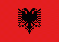
Country - Albania
 |
 |
| Flag of Albania | |
Albania has been inhabited by different civilisations over time, such as the Illyrians, Thracians, Ancient Greeks, Romans, Byzantines, Venetians, and Ottomans. The Albanians established the autonomous Principality of Arbër in the 12th century. The Kingdom of Albania and Principality of Albania formed between the 13th and 14th centuries. Prior to the Ottoman conquest of Albania in the 15th century, the Albanian resistance to Ottoman expansion into Europe led by Skanderbeg won them acclaim over most of Europe. Albania remained under Ottoman rule for nearly five centuries, during which many Albanians (known as Arnauts) attained high-ranking offices in the empire, especially in the Southern Balkans and Egypt. Between the 18th and 19th centuries, cultural developments, widely attributed to Albanians having gathered both spiritual and intellectual strength, conclusively led to the Albanian Renaissance. After the defeat of the Ottomans in the Balkan Wars, the modern nation state of Albania declared independence in 1912. In the 20th century, the Kingdom of Albania was invaded by Italy, which formed Greater Albania before becoming a protectorate of Nazi Germany. Enver Hoxha formed the People's Socialist Republic of Albania after World War II, modeled under the terms of Hoxhaism. The Revolutions of 1991 concluded the fall of communism in Albania and eventually the establishment of the current Republic of Albania.
Currency / Language
| ISO | Currency | Symbol | Significant figures |
|---|---|---|---|
| ALL | Albanian lek | L | 2 |
| ISO | Language |
|---|---|
| SQ | Albanian language |
| EL | Greek language |